運用QGIS於航照資料典藏與管理
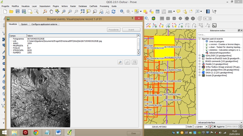
義大利研究單位The Research Institute for Geo-hydrological Protection of Turin,因為研究需要典藏17萬張各時期航照,最早影像可以追溯到1929年。為了有效管理與查找大量航照影像,研究團隊利用QGIS將航照航跡圖進行GIS數位化作業,建立每一張航照的涵蓋範圍(footprint),並使用QGIS以及eVis plugin提供使用者進行影像查找介面。
詳細應用內容,可以進一步參閱:The Research Institute for Geo-hydrological Protection of Turin – Aerial photo archive management