國土空間資料目錄搜尋服務網
2022年7月18日
尚無評論
內政部委託台灣地理資訊中心開發「國土空間資料目錄搜尋服務網」
Categories: Open data
嘉義市政府都發處建置「嘉義市3D空間資訊展示系統」收納單位內各項業管圖資,包括:1,000地形圖、民國103年與107年航照正射影像、都市計畫使用分區等,以預先產製圖磚之方式發布地圖服務,並以3D型式提供民眾查詢瀏覽。
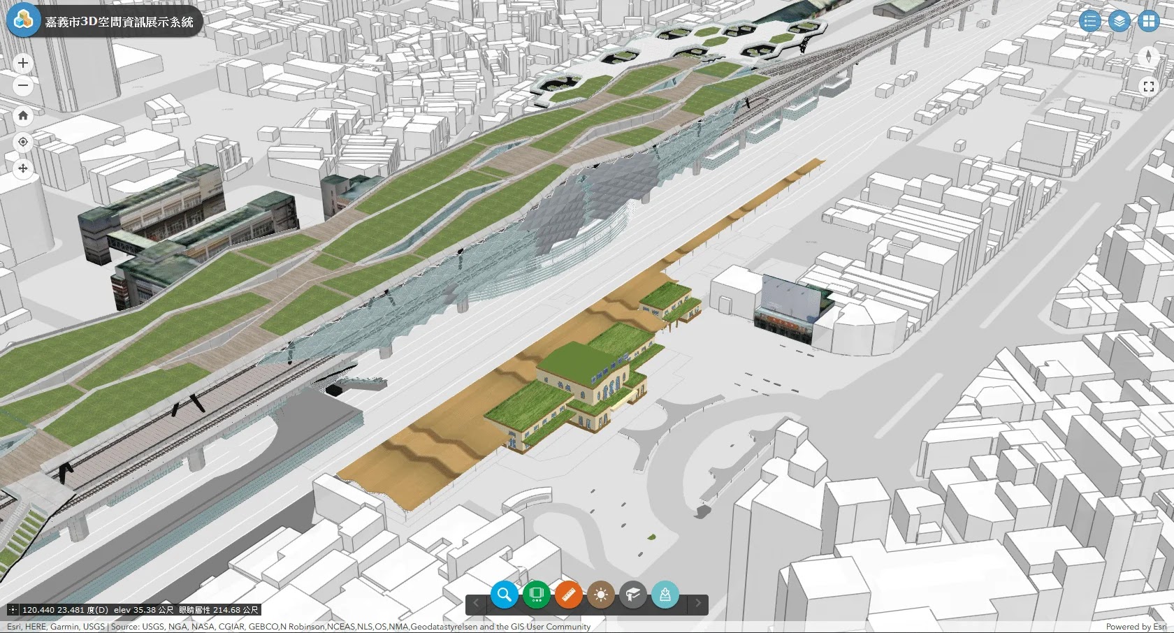
「嘉義市3D空間資訊展示系統」畫面
除了3D GIS圖台之外,也一併開放「嘉義市都市計畫地形圖WMTS服務」,網址:https://3dmap.chiayi.gov.tw/wmts/,包括以下四個圖層,:
※103年航照正射影像
※107年航照正射影像
※1/1,000地形圖(2018)
※都市計畫使用分區
介接使用時需註明出處「嘉義市都發處:嘉義市3D空間資訊展示系統」。
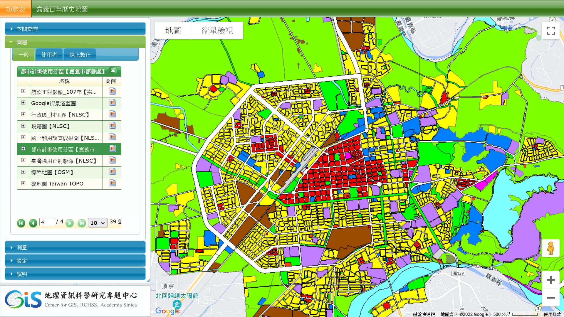
中央研究院人社中心GIS專題中心所開發的『嘉義百年歷史地圖』介接「嘉義市發展處地圖圖磚服務(WMTS)」都市計畫使用分區圖層。
奧地利一家GIS公司EOX,出推Sentinel-2衛星影像加值產品,其中之一是 Sentinel-2 cloudless(全球無雲Sentinel-2衛星影像)產品,涵蓋2016~2021年,使用可以透過WebGIS介面(https://s2maps.eu)來比對不同時期的Sentinel-2衛星影像。

此外,EOX公司也提供WMTS及WMS網路地圖服務,提供非商業使用(需註明出處)。
Sentinel-2 cloudless WMTS及WMS服務網址:https://tiles.maps.eox.at
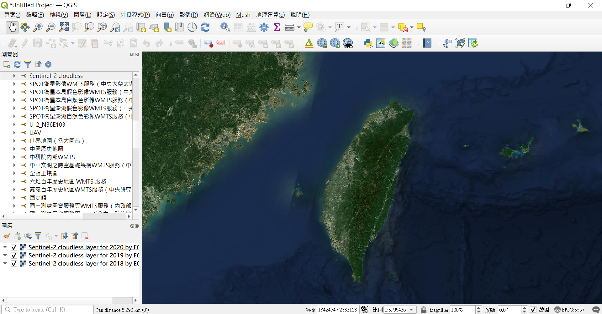
QGIS軟體介接Sentinel-2 cloudless WMTS服務
內政部國土測繪中心國土測繪圖資服務雲(https://maps.nlsc.gov.tw)將像片基本圖民國65年以後版本已全數上線並開放介接。
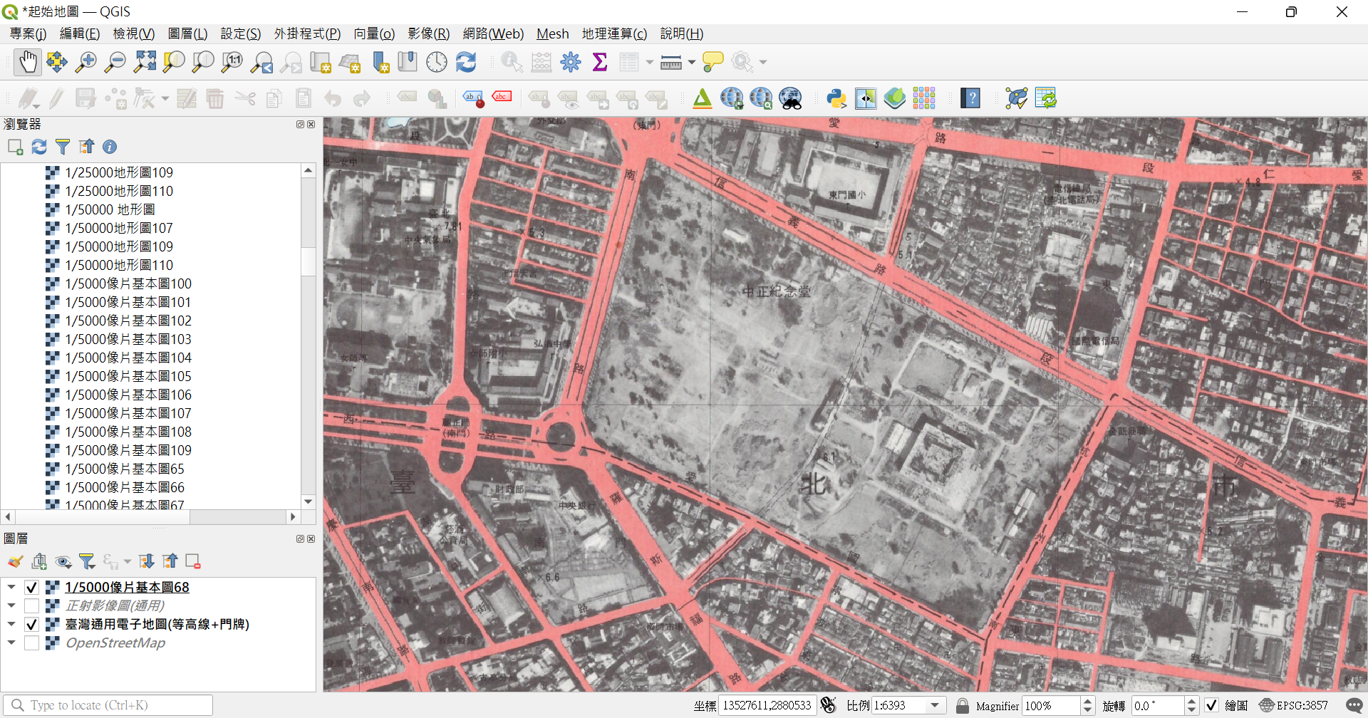
民國68年像片基本圖紀錄正在興建中的中正紀念堂。
網友Manuel嘗試利用運用QGIS軟體及OSM圖資繪製仿古風格(1777 Ferraris map 風格)地圖,稱之為「A modern-day Ferraris atlas」,展現出QGIS強大的圖徵符號(symbology)及標記(label)設計功能。Manuel也將QGIS專案透過GitHub公開,稱之為FerrarGIS,讓其他製圖師可以進一步擴充運用。
FerrarGIS專案:https://github.com/mclaeysb/FerrarGIS
FerrarGIS介紹:https://manuelclaeysbouuaert.be/projects/ferrargis.html

2021 FerrarGIS map of Ghent

1777 Ferraris map of Ghent
進階閱讀:
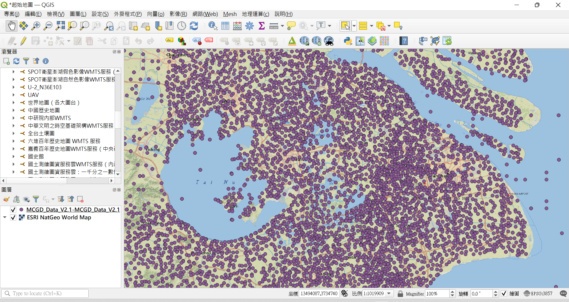
當代中國地理資料庫(Modern China Geospatial Database, MCGD) V2.1提供46萬筆以上與中國大陸有關地名資料(綜合自各種資料來源)大部分都有地理坐標,免費下載配合GIS軟體使用。
https://doi.org/10.5281/zenodo.5866104
內政部提供臺灣各級行政界(縣市、鄉鎮市區、村里)shapefile圖層及WMS/WMTS服務,透過政府資料開放平臺提供各界使用。網友Daniel Kao針對有些線上繪圖軟體(工具)並不支援shapefile格式,而是使用基本json格式的問題,並基於內政部臺灣各級行政界轉檔成JSON格式,稱之為「Taiwan Atlas TopoJSON」資源,亦以MIT授權條款開放。

進階閱讀:
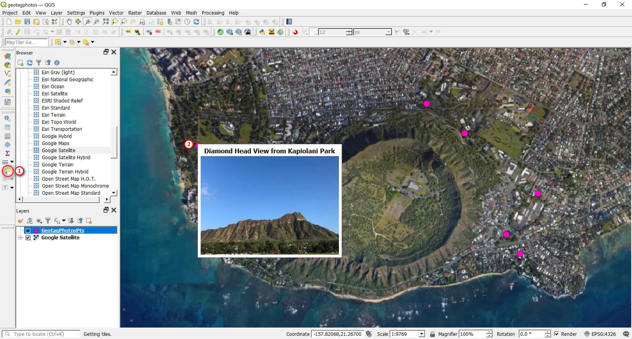
來自波蘭的Open Learning Lab分享一篇介紹「Import Geotagged Photos」功能介紹文章:Mapping and Viewing Geotagged Photos in QGIS