臺灣省地籍藍晒底圖(MAP_LSB7)係根據地籍正圖經人工描繪及整飾而成,用於公告或晒製藍晒圖之用;由內政部國土測繪中心典藏並自行完成數位化共131,872影幅(9,762筆地段),循雙方所簽訂學術合作協議書,提供一套供本計畫典藏,近日完成盤點作業,將全數目錄清單(metadata)已整合至「中央研究院–地圖數位典藏查詢系統」對外開放查詢檢索。
 進階參考:
進階參考:


臺灣省地籍藍晒底圖(MAP_LSB7)係根據地籍正圖經人工描繪及整飾而成,用於公告或晒製藍晒圖之用;由內政部國土測繪中心典藏並自行完成數位化共131,872影幅(9,762筆地段),循雙方所簽訂學術合作協議書,提供一套供本計畫典藏,近日完成盤點作業,將全數目錄清單(metadata)已整合至「中央研究院–地圖數位典藏查詢系統」對外開放查詢檢索。
進階參考:
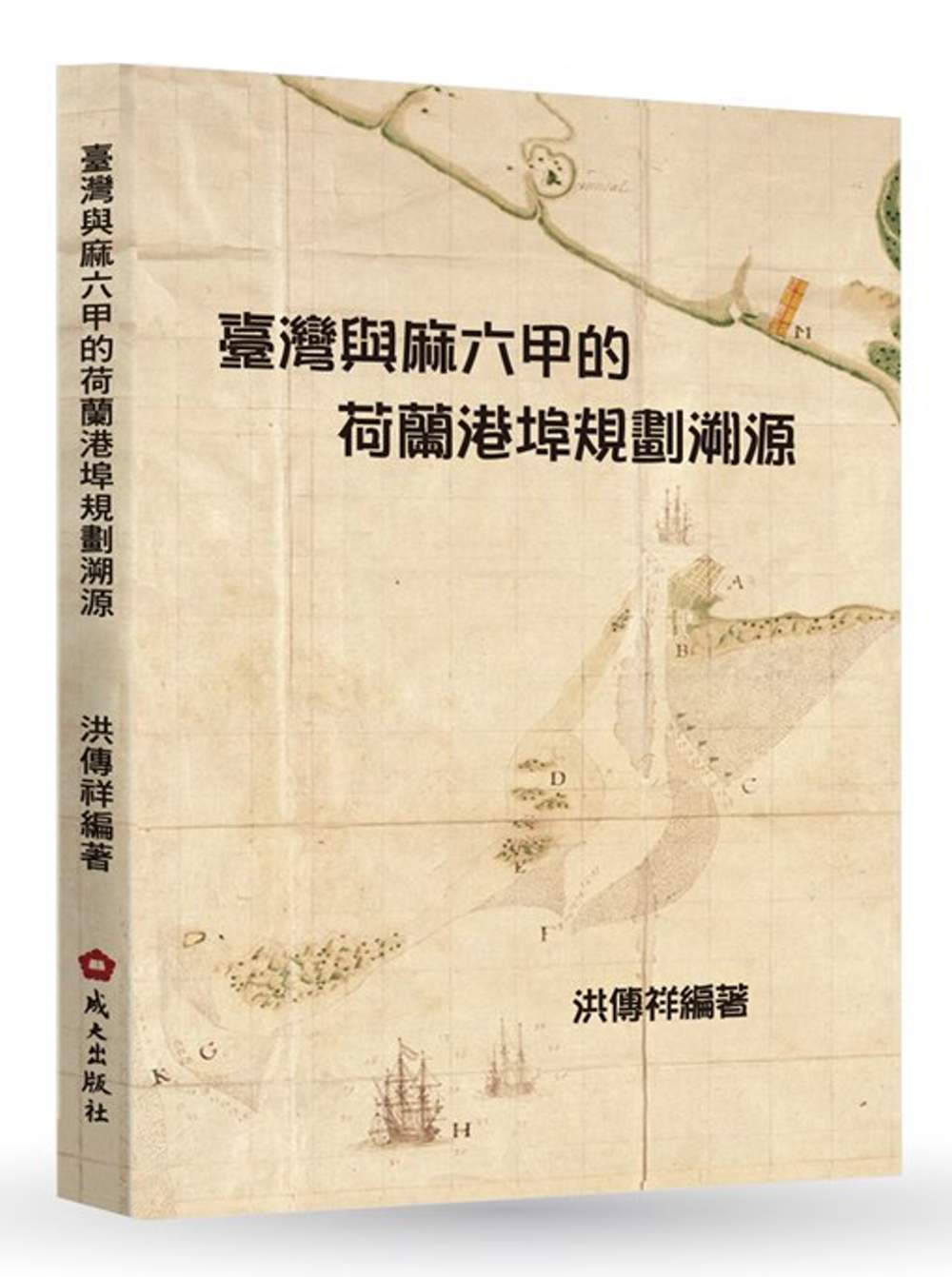
書名:臺灣與麻六甲的荷蘭港埠規劃溯源
作者:洪傳祥、劉政寬、陳盈升
出版社:國立成功大學出版中心
出版日期:2018/1/29
ISBN:9789865635312
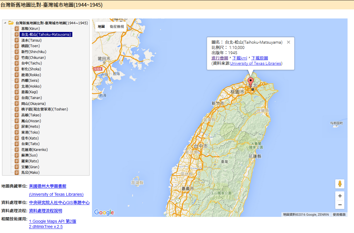
「台灣新舊地圖比對-臺灣城市地圖(1944~1945)」服務因主機調整,對外網址變更為:
http://gis.rchss.sinica.edu.tw/AMCityPlan_1944/
編 號:JMWar_1916
圖組名:日軍攻台戰鬥地圖
比例尺:不定
類 別:主題圖(軍事迅測圖)
測製單位:日軍參謀本部編纂
測製日期:明治38年(1895)測製
發行單位:日日新報社
圖幅數:31幅(索引圖)
製作形式:三色印刷
圖幅大小:尺寸不一
內容提要:1995年遠流出版社所根據日本參謀本部所編纂《明治廿七八年日清戰史》有關台灣部份資料,翻譯出版之《攻台戰紀:日清戰史.台灣篇》,其中包括附冊<日軍攻台戰鬥地圖集>,內容為1895年日軍攻台戰役時的軍事攻防地圖,地圖上地形資訊對於歷史地理研究仍具參考價值。
典藏機關:各大圖書館。
備 考:典藏完整;已上架至「臺灣百年歷史地圖系統」。
展覽名稱:「華美協同合作空戰史實回顧展」
展覽時期:自5月4日起至7日止,每日上午10時至下午5時30分
展覽地點:在空軍官兵活動中心介壽堂展出(臺北市仁愛路3段145號)
相關報導:
1945年 二次世界大戰結束,臺灣光復
1946年 大臺北綜合都市計畫草案,預計收容人口數為100萬,本草案未實施。
1947年 臺北市都市計畫用途分區圖
1948年 臺北市都市計畫圖
1951年 臺北市都市計畫圖
1956年 臺北市都市計畫,北市工字第14417號公告
1956年 臺北市都市計劃道路系統圖
1966年 臺北市都市計畫分區使用圖
1966年 臺北市都市計畫參考圖
1967年臺北市升格為院轄市後
1968年 臺北市綱要計畫,預計收容人口數為250萬
1978年 臺北市綜合發展計畫,預計收容人口數為350萬
1979年 臺北市都市計畫分區使用圖
1981年 臺北市都市計畫主要計畫圖
1994年起因修憲,臺北市從院轄市改制為直轄市
1997年 臺北市土地使用分區圖
2010年 臺北市綜合發展計畫書
參考資料:
打狗文史再興會社先前曾與哨船頭里長楊宗正,企劃「天下第一里哨船碼頭觀光地圖」;2013年推出「哈瑪星時空旅圖」,透過重繪一百年前後哈瑪星街道與建築,述說哈瑪星歷史與人文風情;2014年則進一步推出美耐斯的「鹽埕戀歌—鹽埕漫步地圖」,記錄40個鹽埕區產業、職人的店家,仿造舊廣告形式,以簡短扼要又不失完整的文字介紹店家,讓民眾一探究竟。
 打狗文史再興會社2013發行「哈瑪星時空旅圖」
相關報導:
內政部營建署委託中央大學太空及遙測研究中心運用為衛星影像針對台灣國土進行長期「國土利用監測計畫」。

該計畫運用衛星影像分析各重要都會區的周邊土地發展情勢,藉由Landsat系列衛星影像,以十年為週期(1980年~2010年)分別探討臺北市、新北市、臺中市、臺南市及高雄市的都市化程度與交通運輸系統發展之間的趨勢變化,供全民進一步了解五都在時間與空間上發展歷程的演變。

詳細五都都市化變遷趨勢請參閱:http://www.landchg.org.tw/LandChgSys/page5.htm。
美國國會圖書館地理及地圖部門,擁有超過500萬幅的地圖、7萬2000本的地圖集,以及6000本的參考資料,藏品之豐富及內容多樣且珍貴,是世界上重要的地圖資料庫之一。而自1800年國會圖書館建立時,地理及地圖部門也是第一個被成立的部門。總括來說,美國國會圖書館地理及地圖部門,藏品的內容包羅萬象,世界各地及區域內政治實體所包含的各種官方地誌、礦產土壤資源、航海圖、地理叢書等,皆有所收藏。部分資料已經透過數位化方式,透過網際網路提供各界自由和開放使用,但這些只是佔美國國會圖書館地理及地圖部門很小部分收藏。
中央研究院於民國93年10月與美國國會圖書館正式簽訂學術合作協議書,雙方建立長期合作研究與數位典藏資料流通交換的互惠關係。並在院內「利用數位典藏改善學術研究環境計畫」經費支持下,分別於93~96年執行「美國國會圖書館典藏之中國相關地圖文獻清查計畫」以及97~98年執行「美國國會圖書館暨國家檔案館典藏之空間圖資數位典藏計畫」,就美國國會圖書館地理地圖部所典藏的中國相關地圖,雙方共同合作,進行數位化保存與應用。
歷年共計完成81,239張地圖影像拍攝,估計完整的地圖應有70,000張以上及3,100餘張記載地圖資訊之封面與地圖索引影像,後續將持續進行上述地圖之資料整理與建檔工作。同時,也已經建立「美國國會圖書館典藏之中國相關地圖文獻查詢系統」逐步將成果公開。歷年數位成果清單如下:
◎2004年(多為單幅地圖)
◎2005年(地圖冊與地圖集)
◎2006年(地形圖-東南部省分)
◎2007年(地形圖-滿州地區)
◎2008年(滿州地區與亞洲小比例尺地圖)
Ortho-image(Procedure of aerial photos with ortho-recification)
The scales of photos are similar while taking a photo perpendicularly to the ground at the same location. After rectifying these photos, they can be used to produce maps. This procedure will save time and money for the ground investigation and survey. To mosaic a series of equivalent scale ortho-images that covers an area will show the whole aspect view of this area. Taiwan’s 1/25000 photo fundamental maps are manufactured by ortho-photos.
Tilt image
A sidelooking airphoto is taken from the windows in a plane. People can easily interpret and recognize the topography from the photos without any training.