國內、外地圖數位典藏資源

Monday, July 26th, 2010


國內機構
荷西時期臺灣輿圖
網址http://ithda.ith.sinica.edu.tw/formosalook/
簡介:中央研究院臺灣史研究所建置,收錄十六至十八世紀「荷西時期」的臺灣輿圖,資料庫內容包含輿圖題名、輿圖產出者、出現年份、輿圖說明等,網站並提供臺灣輿圖相關圖書目錄、研究書目及相關資訊,提供早期台灣史研究參考。
  日治時期臺灣地圖資料庫
網址http://stfj.ntl.edu.tw/
簡介:國立中央圖書館臺灣分館建置,收錄日治時期臺灣各式地形圖、主題圖,共計1,117 筆,除了提供目錄檢索功能之外,可以下載地圖影像以及檢索後分類,是研究日治時期臺灣地理、地圖的重要參考資料庫。
地質知識服務網地質影音館-精選古地質圖
網址http://twgeoref.moeacgs.gov.tw/GipOpenWeb/
簡介:經濟部中央地質調查所建立的地質知識服務網,廣泛收集臺灣地質相關地圖以及建立GIS服務系統,其中挑選53張日治時期古地質圖,透過地質影音館提供一般大眾線上瀏覽。
國家文化資料庫-古地圖
網址http://nrch.cca.gov.tw/ccahome/map/
簡介:文化建設委員會所建立的國家文化資料庫整合國立台灣博物館、國立臺灣歷史博物館、台北二二八紀念館等單位歷年數位典藏成果,其中圖像及地圖資料合計超過1,500筆,提供metadata與縮圖瀏覽。
Taipei 臺北市文獻委員會館藏-地圖
網址http://210.69.61.47/Taipei_Search/
簡介:臺北市文化局文獻委員會針對館藏文獻資料進行數位化典藏,其中地圖資料合計291筆,提供metadata與縮圖瀏覽。
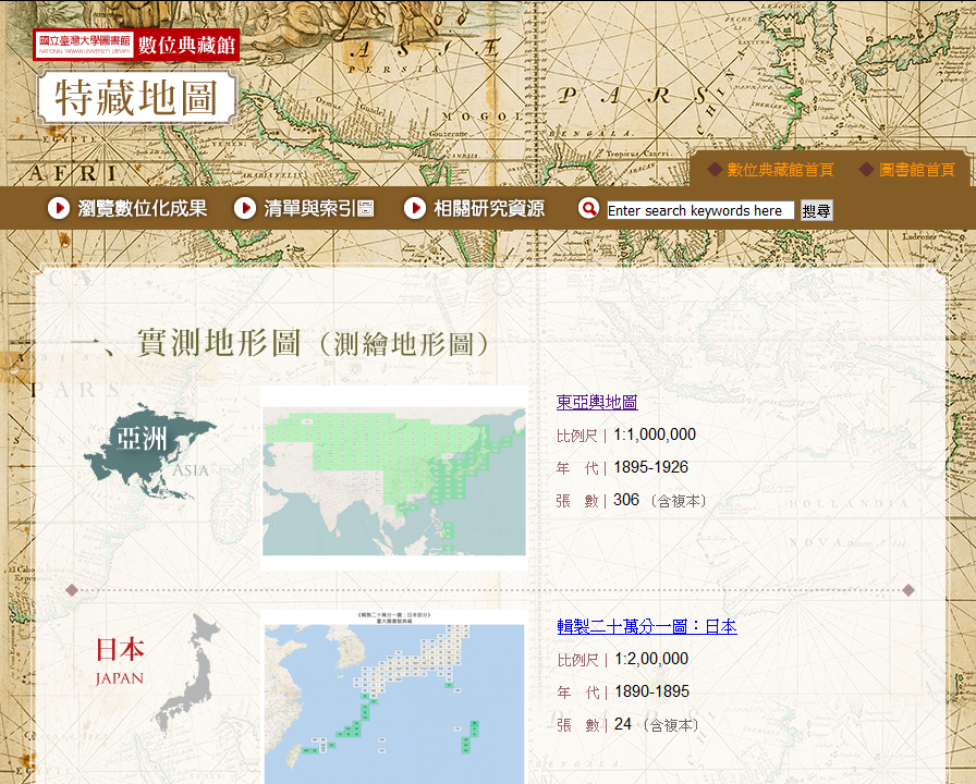
國立臺灣大學圖書館特藏地圖
網址http://cdm.lib.ntu.edu.tw/cdm/landingpage/collection/maps
簡介:收錄臺大圖書館特藏組庋藏地圖目錄與清單,主要來源除臺北帝國大學(臺大前身)附屬圖書館以及各系所專門教室(研究室),內容以日本在明治時期至二戰結束之間所測繪的各式東亞地圖(「外邦圖」)為主。
海外機構
  中華輿圖
網址:http://tweb.tianditu.com/guditu/
簡介:中國大陸國家測繪地理訊息局建置,收錄中國歷代所繪製的古地圖,可以按並提供中國古地圖及製圖名家相關知識,是一個兼具研究參考與科普教育的地圖主題網站。
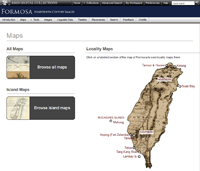
 Reed_Map_s Formosa: 19th Century Images
網址http://academic.reed.edu/formosa/
簡介:該網站由美國奧勒岡州里德學院(Reed College)歷史系費德廉教授所建立,收錄十九世紀臺灣的各式圖像資料,包括:地圖、插畫與照片,主要針對外國人所留下的臺灣史料,並進行全面性的整理,並將各種不同語言的文字記錄一一翻譯成英文,成為目前最完整、翻譯最詳盡的19世紀台灣史資料庫,並廣為國內文史工作者所援用。
京都大學典藏中國古地圖
網址http://kanji.zinbun.kyoto-u.ac.jp/db-machine/imgsrv/maps/
簡介:日本京都大學人文科學研究所建置,典藏明清及民國時期中國地圖,主要為區域或城市地圖,共計46 筆,網站提供高解析度影像下載。(目錄清單)
Atlas of Mutual Heritage (AMH)
網址http://www.atlasofmutualheritage.nl
簡介:該資料主要針對荷屬東印度公司(VOC)及荷屬西印度公司(WIC)涵蓋殖民地或貿易地的地圖與圖像資料,資料來源則是整合歐洲各大博物館收藏,網站提供線上影像瀏覽,主要為17及18世紀相關資料,中國有130筆,臺灣有54筆。
香港科技大學典藏古地圖(Antigue Maps)
簡介:香港科技大學圖書館典藏逾230件古地圖,內容包含16~19世紀亞洲地圖相關地圖,主要是西洋人所繪製的中國古代地圖,包括單幅的作品與成冊的地圖集,該網站提供資料庫檢索以及下載縮圖影像PDF檔,與臺灣有關地圖有12筆。2002年曾舉辦「地圖中國 – 圖書館特藏展」,從其中挑選55幅地圖出版「China in European Maps – A Library Special Collection (地圖中國)」專書。
澳洲國立圖書館(NLA)地圖收藏
網址http://www.nla.gov.au/what-we-collect/maps
簡介:澳洲國立圖書館典藏超過60萬件地圖,其中包含大量澳洲地形圖與航空照片。2000年左右推動Rare Maps Digitisation Project目前已經完成有1萬6千餘件地圖數位化,其中與臺灣有關的地圖約有40餘張,與中國大陸相關地圖則有300餘張。該網站提供資料庫檢索以及線上高解析度地圖瀏覽。
歐洲數位圖書館(Europeana)地圖收藏
網址http://www.europeana.eu/portal/
簡介:歐洲數位圖書館(Europeana)是整合歐盟內2,200各單位的相關文化數位典藏成果,目前有2千3百萬件的收藏,可以說是歐洲文化入口網(portal),該網站中與臺灣有關的地圖約有10餘張,該網站提供資料庫檢索以及線上詮釋資料及縮圖瀏覽功能。
地理空間資料保存資源中心
網址http://geopreservation.org
簡介:The Geospatial Data Preservation Resource Center是美國國會圖書館所推動的國家數位資訊基礎環境及典藏計畫(National Digital Information Infrastructure and Preservation Program,NDIIPP)下的分支項目,主要是提供地理空間資料的永久保存技術、規範及工作的參考資源,該中心致力於透過網站、工作坊及教學文件等方式來推廣地理空間資料的永久保存觀念與技術。
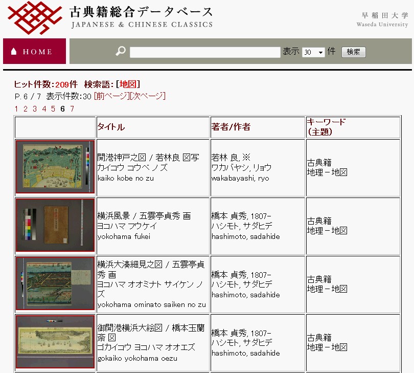
waseda_s 日本早稻田大學古籍文獻數位典藏資料庫
網址http://www.wul.waseda.ac.jp/kotenseki/
簡介:日本早稻田大學圖書館特別資料室典藏近30萬冊圖書、2件國寶、5件重要文化財,自2005年開始進行數位典藏工作;該資料庫為古籍文獻數位典藏公開成果,其中包括清代以前中國相關圖書及地圖文獻資料。
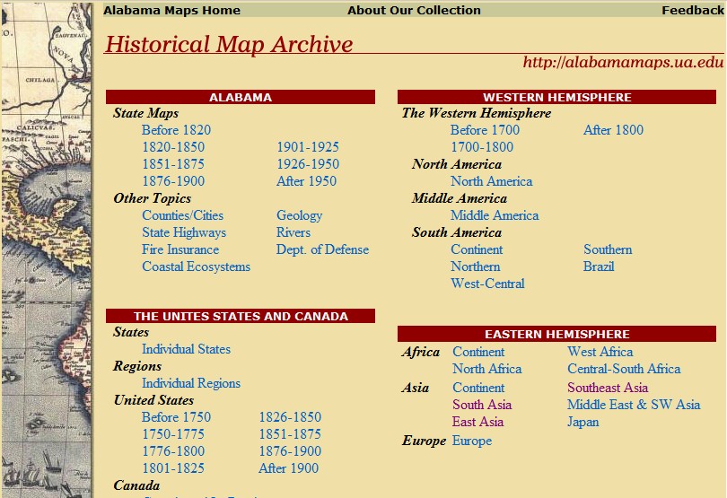
Alabama_Maps 美國阿拉巴馬州立大學地理資訊數位典藏
網址http://alabamamaps.ua.edu/
簡介:美國阿拉巴馬州立大學(University of Alabama)典藏大量地圖及航空照片,截至2012年年底已經完成5萬6千餘張地圖及1萬4千餘張航照數位化,典藏阿拉巴馬州及美國本土地圖及航照為主,亦有17~19世紀世紀各國地圖以及二戰時期美軍測製各國地形圖。
UO_libraries 美國奧勒岡大學地圖及航照圖書館
網址http://library.uoregon.edu/map/
簡介:美國奧勒岡大學(University of Oregon)圖書館系統下有設立一Map & Aerial Photography (MAP) Library,其中包括豐富的東亞及東南亞地形圖,中國大陸及台灣地區典藏主要是美軍所繪製的地形圖。
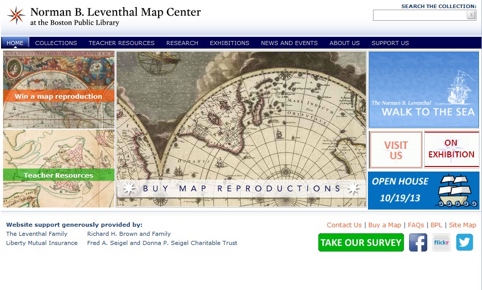
Norman_B._Leventhal_Map_Center_s 美國波士頓公共圖書館地圖中心
網址http://maps.bpl.org/
簡介:美國波士頓公共圖書館(Boston Public Library)從2004年設立The Norman B. Leventhal Map Center,館藏有20萬件地圖及5千冊地圖集,並積極從事地圖數化及地圖教育推廣工作。其中有關於中國相關的地圖典藏有38件,提供數位圖檔免費下載。
USC 美國南加大數位圖書館
網址http://digitallibrary.usc.edu/cdm/
簡介:美國南加大數位圖書館(USC Digital Library)有豐富館藏其中有批一亞洲地圖特藏資料(Asian Maps Collection),其中有關於中國相關的地圖典藏有58件,提供線上閱覽。
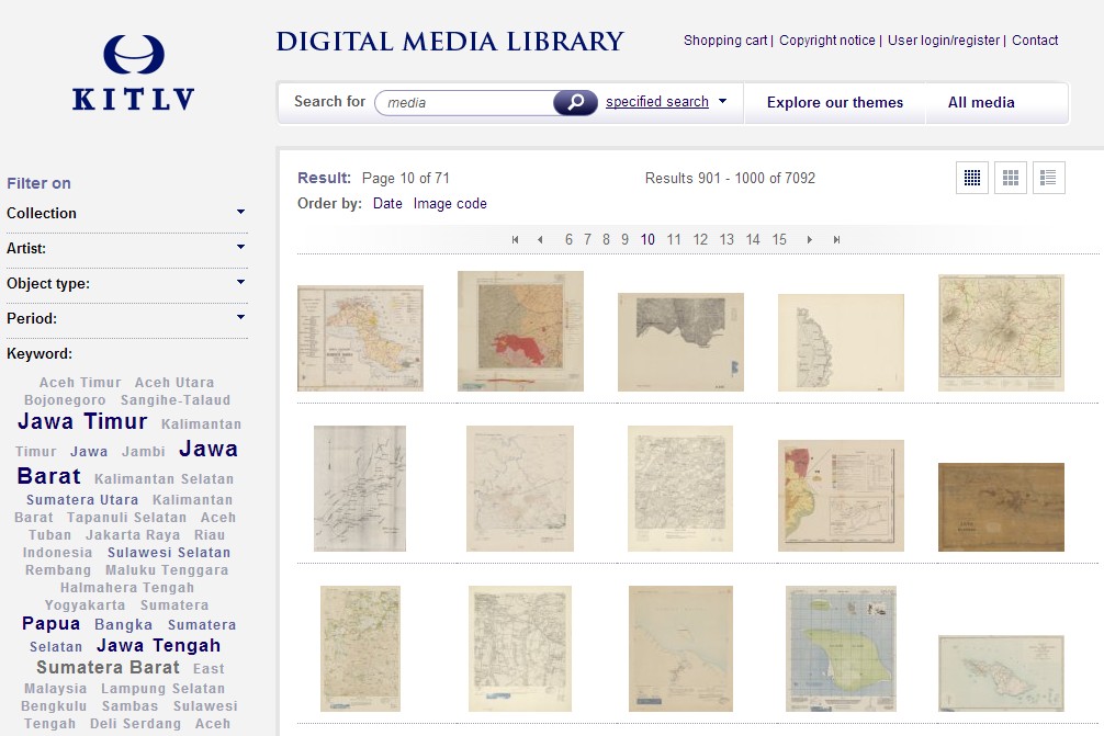
KITLV_DMLs 荷蘭皇家東南亞及加勒比研究所
網址http://media-kitlv.nl/
簡介:位於荷蘭萊頓市荷蘭皇家東南亞及加勒比研究所(KITLV)圖書館,典藏大量東南亞地區地圖及老照片影像,並完成線上數位媒體圖書館(Digital Media Library)。
BnF 法國國家圖書館
網址http://gallica.bnf.fr
簡介:法國國家圖書館(Bibliothèque nationale de France,BnF)匯集法國重要文獻資料,館藏有豐富的中文古代資料,目前線上有古代臺灣地圖23筆,中國地圖57筆。
AGSL 美國地理學會圖書館
網址http://collections.lib.uwm.edu/cdm/landingpage/collection/agdm
簡介:美國地理學會圖書館(The American Geographical Society Library)典藏地圖,由美國威斯康辛大學密爾瓦基分校(University of Wisconsin-Milwaukee)圖書館執行數位化計畫,共完成700餘件地圖掃描,目前線上有中國地圖67筆。
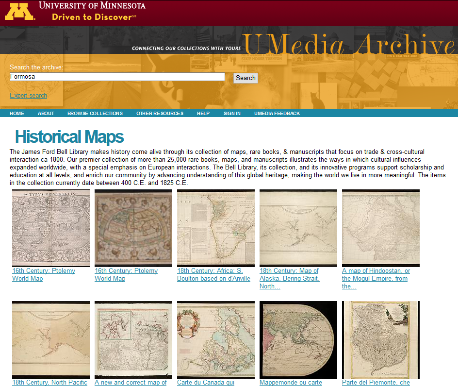
螢幕截圖 2016-06-27 12.25.22 美國明尼蘇達大學James Ford Bell圖書館
網址https://www.lib.umn.edu/bell
簡介:Bell Library位於明尼蘇達大學雙城校區(Twin Cities)Elmer L. Andersen Library內,該館特色典藏為16~18世紀的善本書、地圖及手稿,目前正在進行善本書內的古輿圖掃描作業,預計完成22,413幅地圖掃描建檔並上網公開


Remote Sensing

Tuesday, November 17th, 2009
  • Europe’s eoPortal
  • Commercial Imagery & Aerial Photography list
  • SpaceImaging
  • Globexplorer
  • TerraServer
  • EarthSat
    Global Satellite Images with 15m resolution, one frame (500kmx600km) for 150 US dollars.
  • QuickBird
  • SPOT , LandSat
  • FormoSat Image Delivery Center in NTU
  • FormoSat Image Delivery Center in NCU CSRSR
  • SpaceImaging Co.
  • Earth From Space
    A database of many of the best, astronaut acquired photos of the Earth.Images can be searched easily by various areas of interest:cities, weather, features, technical, etc.
  • NASA Image eXchange
    NIX is an engine for simultaneously searching multiple NASA online image and photo collections. Searching is done using key-words.
  • NASA-JSC Digital Image Collection Home Page
    This collection includes all cataloged Shuttle mission Earth-looking imagery from the first Shuttle mission,STS-1, through the most recently cataloged Shuttle mission,STS-76. Search by text or graphically by mission.
  • Planetary Photojournal
    A good resouce for classes that want to compare images to Earth to those of other planets. Includes radar images as well as visible light.

Images

Tuesday, November 17th, 2009
  • Space Science and Engineering Center-Real Time Data
    This page links to daily GOES satellite images and composites, sea surface temperatures, and a volcano watch. Images are in visible and infrared(IR) spectra and water vapor.
  • Global Rainforest Mapping Study-Amazon
    The Global Rainforest Mapping project (GRFM) by the Japanese JERS-1 Synthetic Aperture Radar (SAR) was begun in mid-1995. This project seeks to map the worlds rainforest regions to high resolution by using this Earth-orbiting SAR. By mapping these regions during a single season, a number of interesting scientific questions may be answered

Aerial Photography

Tuesday, November 17th, 2009

Geography

Tuesday, November 17th, 2009
  • Earth Week
    A weekly summary of important natural and manmade events in the environment worldwide.(Archive summaries available.) archives of 95-97 are on earthweek.com.
  • Earth and Moon Viewer
    A Web site where you can view the Earth in many different ways, including by latitude and longitude, above various cities, etc.
  • Geography-about
    A Web site with a lot of information about geography, including many maps, news, and a glossary of terms. It also includes many links to other sites.
  • GEOnet Names-National Imagery and Mapping Agency(NIMA)
    The GEOnet Names Server(GNS) provides access to the National Imagery and Mapping Agency’s(NIMA) database of foreign geographic feature names.
  • Oceanogrphy from the Space Shuttle
    This is a photographic survey of oceanic phenomenon visible to the naked eye acquired by NASA astronauts. Included are sets of internal waves, pollution at sea, and coatal phenomena.

Maps

Tuesday, November 17th, 2009
  • Perry-Castaneda Library Map Collection
    The website of the map research group form Institute of Human Geography, Graduate School of Letters, Osaka University
  • 外邦圖研究
    The website of the map research group form Institute of Human Geography, Graduate School of Letters, Osaka University
  • Maps in Our Lives (the Library of Congress exhibition)
    This exhibition is presented in recognition of a thirty-year partnership between the Library’s Geography and Map Division and the American Congress on Surveying and Mapping (ACSM), the nation’s primary professional organization dedicated to surveying and mapping activities.

NASA Resources

Tuesday, November 17th, 2009
  • NASA Homepage
    From this home page, you can access most of the NASA Web sites, including the NASA Centers(under Welcome to NASA Web),Earth Science(formerly Mission to Planet Earth), and more.
  • Destination:Earth
    the website for the NASA Earth Science Enterprise. Thank you for visiting our site. I know this means you care about our home–Planet Earth–the only one in our solar system we have found that supports life.
  • NASA Spacelink
    Spacelink has a great Internet search engine. It provides links to virtually every one of NASA’s Web pages. It also has a useful index page for Images of Earth From Space.
  • NASA CORE Central Operation of Resource for Educator
    The NASA Central Operation of Resources for Educators (CORE), established in cooperation with Lorain County Joint Vocational School, serves as the worldwide distribution center for NASA-produced multimedia materials. For a minimal charge, CORE will provide a valuable service to educators unable to visit one of the NASA Educator Resource Centers by making NASA educational materials available through its mail order service.
    Through CORE’s distribution network, the public has access to more than 200 videocassette, slide, and CD-ROM programs, chronicling NASA’s state-of-the-art research and technology. Through the use of these curriculum supplement materials, teachers can provide their students with the latest in aerospace information. NASA’s educational materials on aeronautics and space provide a springboard for classroom discussion of life science, physical science, space science, energy, Earth science, mathematics, technology and career education.
  • How to Access Information on NASA’s Education Program, Materials, and Services
    NASA Educator Resource Center and PDF file online

Weather National Climatic Data Center

Tuesday, November 17th, 2009
  • National Climatic Data Center
    “Billion Dollar U.S. Weather Disasters 1980-1996” and more than 100 images from hurricanes and other types of storms dating back to 1970. 
  •  The Weather Hotlist
    A site which brings together many different current weather monitoring tools, from many different sources. See world or regional weather. Good tool for the mission.

Shuttle

Tuesday, November 17th, 2009

Reference

Monday, November 9th, 2009
  • CIA World Factbook 2001
    Provides detailed information about specific countries, such as geography, population, land use, natural resources,etc. 
  • OpenGIS Consortiun
    OpenGIS Specifications
    Click for for access to approved OpenGIS Abstract and Implementation Specifications
  •  D. ISO TC211 
  • Geomorphology from Space:A Global Overview of Regional Landforms
     A good resource for teachers. This out of print book is available online and on CD-ROM; order CD from Goddard DAAC for free:daacuso@daac.gsfc.nasa.gov
  • Goddard Institute for Sapce Studies
    GISS is a NASA facility that primarily studies global change. This site has extremely technical data on surface temperatures, vegetation, human population density, wetlands, ect.
  • Library of Congress Country Studies 
    This site includes descriptions of 85 countries. Each study is written by a multidiscplinary team of social scientists and includes sections on history, geography, economy, society, and others. 
  • Mad Scientist Network
    This is a fun, yet informative site where students can ask scientists questions. Already asked questions are available for viewing. 
  • U.S.Geological Survey 
    A good reference site, including science topics for education, mapping information, and current events and news releases.
  • Unites Nations InfoNation
    InfoNation is an easy-to-use, two-step database that allows you to view and compare the most up-to-date statistical data for the Member States of the United Nations. Has Spanish and French version.