完成臺北市地政局典藏重測後地籍原圖數位典藏

Thursday, November 14th, 2019

臺北市改制為院轄市以後,遭遇到日治時期地籍圖因為圖紙折損破舊、伸縮變質、內容模糊等原因,嚴重影響地籍圖精度,造成土地管理上的困擾,因此依據內政部頒訂之「臺灣地區土地測量計畫」,自民國65年度起開始辦理地籍圖重測,於民國77年6月30日全部辦理完竣,期間繪製比例尺一千分之一或五百分之一之地籍圖。

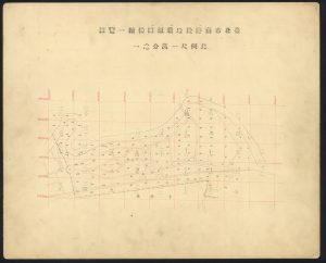
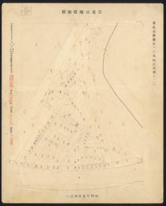
本計畫於107~108年度與臺北市政府地政局合作,將該局典藏之重測後地籍原圖進行數位化保存,合計完成194個地段、10,218 幅地籍圖(含一覽圖171幅),是研究臺北市城市空間演變的基礎資料。(需特別注意,這批地籍原圖已經全面向量化(GIS化),已經停止更新與供應。

臺北市南港段地籍原圖接續一覽圖(比例尺一萬分之一)

臺北市南港段地籍原圖129幅之內第12號(比例尺五百分之一)

臺灣百年歷史地圖系統新增圖層

Wednesday, November 13th, 2019

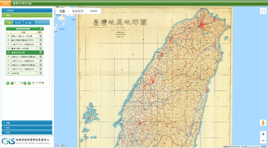
臺灣百年歷史地圖系統」新增1項歷史圖層:民國77年3月行政院農委會委託航空測量及遙感探測學會編製二十五萬分之一臺灣地區地形圖。

  • 1988-臺灣地區地形圖(1/250,000)

新書出版:《臺北歷史.空間.建築》

Friday, November 1st, 2019

書名:臺北歷史.空間.建築:新莊、艋舺、西門、大龍峒、圓山、劍潭
作者:王惠君
出版社:左岸文化
出版日期:2019/7/3
ISBN:9789865727895

研究論文:從「本島森林的主人翁」到「在自己的土地上流浪」:臺灣森林計畫事業區分調查的再思考(1925-1935)

Monday, October 28th, 2019

洪廣冀、羅文君、胡忠正(2019) 從「本島森林的主人翁」到「在自己的土地上流浪」:臺灣森林計畫事業區分調查的再思考(1925-1935),臺灣史研究 ; 26卷2期 (2019 / 06 / 01) , pp.43-111。

摘要:

臺灣歷史上的「蕃地」是如何轉變為國有林班地與原住民保留地?面對此臺灣史研究的經典議題,論者均同意,大正14年至昭和10年(1925-1935)之森林計畫事業中的區分調查,扮演了重要角色。即便如此,受到史料限制,對區分調查的起源、過程與結果,論者往往眾說紛紜,甚至對「要存置林野」、「準要存置林野」與「不要存置林野」等類別的定義,都還有值得商榷之處。所幸,區分調查的原始檔案目前仍保存在行政院農業委員會林務局,而中央研究院人社中心地理資訊科學研究專題中心已全數複製收藏。本文即運用這批已公開、然少為研究者重視的史料,一方面導讀這批史料,另方面也為前述臺灣史之經典議題提出新的歷史解釋。本文首先聚焦在矢內原忠雄與李文良就區分調查的見解,梳理兩造的異同點。其次,以此異同點為基礎,對照這批史料,試著為下列根本問題提出回答:為何區分調查會查定絕大面積的要存置林野?準要存置林野的起源與內涵為何?不要存置林野是否為預備要處分給資本家經營的土地?第三,簡述區分調查之原始檔案的內容與規模,並以最早完成的南庄調查區為例,結合目前典藏在國立臺灣大學圖書館的〈蕃人所要地調查書〉,說明這批史料有助於釐清1920年代臺灣的行政空間、林政空間與原住民的生活空間。最後,本文主張,區分調查的原始檔案不僅反映出殖民林業部門在將蕃地納入一套科學林業體制時的理論與實作,更為理解臺灣之資本主義化與國家化、日本帝國作為帝國民族國家之特殊性等議題的關鍵史料。同等重要的,有鑒於晚近臺灣原住民族轉型正義的呼聲,區分調查之原始史料更可為相關討論提供一個基礎,讓研究者得以與下列問題正面對決:為何臺灣原住民會從「本島森林的主人翁」到「在自己的土地上流浪」?

下載全文:http://www.ith.sinica.edu.tw/quarterly_history_look.php?l=c&id=659

新書出版:《尋找湯姆生:1871臺灣文化遺產大發現》

Friday, October 18th, 2019

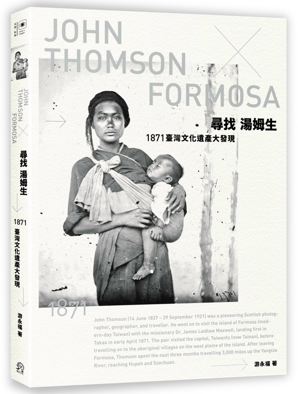
書名:尋找湯姆生:1871臺灣文化遺產大發現
作者:游永福
出版社:遠足文化
出版日期:2019/10/30
ISBN:9789865080433

中華文明之時空基礎架構(CCTSLite)系統新增圖層

Thursday, September 19th, 2019

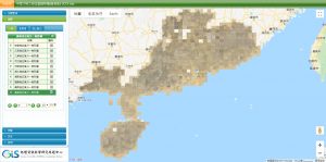
中華文明之時空基礎架構新增4項歷史圖層。

  • 江西省五萬分一地形圖(1940)
  • 湖南省五萬分一地形圖(1940)
  • 廣東省五萬分一地形圖(1940)
  • 廣西省五萬分一地形圖(1940)

新書出版:《地圖的故事:悠遊在現實與想像、科學與藝術之間的地圖學發現之旅》

Thursday, September 19th, 2019

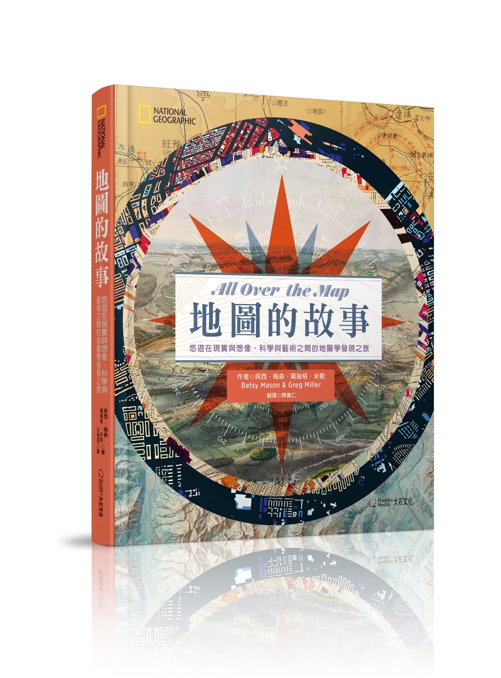
書名:地圖的故事:悠遊在現實與想像、科學與藝術之間的地圖學發現之旅
作者:Betsy Mason(貝西.梅森), Greg Miller(葛瑞格.米勒)
譯者:陳義仁
出版社:大石國際文化
出版日期:2019/9/10
ISBN:9789578722583

花蓮百年歷史地圖系統新增圖層

Friday, September 6th, 2019

花蓮百年歷史地圖系統」新增6項歷史圖層。

  • 1923-秀姑巒溪河川測量原圖(1/2,500)
  • 1932-秀姑巒溪平面圖(1/2,500)
  • 秀姑巒溪流域航拍(1952)
  • 立霧溪流域林相圖(1956)
  • 立霧溪流域地形圖(1957)
  • 1957-新城灌溉區域地形圖(1/2,500)

研究論文:江南地區聚落-城鎮歷史形態演化的發生學考察

Tuesday, September 3rd, 2019

钟翀(2019) 江南地区聚落-城镇历史形态演化的发生学考察,上海城市管理2019年04期,頁72~78

摘要:

近代以來在江南地區製作的大比例尺實測地圖,雖然反映了該區域近代聚落與城鎮在某一時間斷面靜態面相,但如果立足於聚落形態發生學理論,選取適量樣本並通過類型化與進化階序分析,則可在相當程度上洞悉該區域聚落-城鎮歷史形態學特質與演化的歷程。通過運用現存的此類地圖,系統探討該區域聚落-城鎮內部形態的成長歷程,並深入思考其背後所蘊含的長期演進史。考察可知,江南地區的聚落形態演化有著較為穩定的進化方向與演變規律,在多重因素作用下,該區域的聚落進化可歸納為“列狀水路村落-列狀水路市鎮-交叉狀水路市鎮-複合型水路城鎮”這樣的典型發展模式。

DOI:10.3969/j.issn.1674-7739.2019.04.013

研究論文:ギメ美術館図書館所蔵の東アジア関係地図について(On the Maps of East Asia in the National Museum of Asian Arts Guimet Library)

Friday, August 2nd, 2019

大澤 顯浩(2019) ギメ美術館図書館所蔵の東アジア関係地図について : ヴィシエール・コレクションを中心にして,言語・文化・社会 (17), 33-61, 2019-03

摘要

The Chinese maps of the Vissière Collection are not very familiar. However, in the 2018 exhibition “The world seen from Asia: Le Monde vu d’Asie” held by the Guimet Museum (Musée national des arts asiatiques Guimet: MNAAG), various old maps and pictures relating to Japan, China, Korea, Southeast Asia, Tibet, Central Asia and West Asia were exhibited. The exhibits included items from the Vissière collection, which attracted attention. The Vissière collection was donated to the National Museum of Asian Arts Guimet Library (the Guimet Museum Library) in 1973 by the daughter-in-law of Arnold Vissière, and it is made up of important books and 105 maps. It is thought that the maps collected by Vissière are mostly the ones obtained by him doing diplomatic service in late- Qing Dynasty China. Together with other added after he returned to Paris. Many of the maps in the collection items concern military affairs and administration, and were created by public institutions in China. They include rare items such as prefectural maps, illustrations of tombs, prison plans, and so on. There are also maps concerning waterways such as the Grand-Canal and the Yellow River. The collections also reflects Qing relations in the 1880s and 1890s with Japan, and with Russia over Korea. There are relatively many maps of the northeastern part of China including the Manchuria-Korea border, and there are maps of Indochina, including the French colonies, and of Southwest China including Yunnan 雲南, Guangxi 廣西. There are other maps of various places in China, a map of the provinces including Central Asia, etc. Among these are maps published in Japan and the UK. The Guimet Museum Library also includes maps collected by Èmile Guimet, founder of the Guimet Museum, and route maps of Yunnan, ordered by Yunnan Consul-General Auguste François. Vissière was trying to create an accurate place-name dictionary and map of China for basic reference. Behind Vissière’collection we can see the will of French cartographers to explore the unknown world and to fill in the blank spaces. A finding map for the catalog of the Guimet Museum Library is provided in the appendix to this paper.

參考資訊:https://ci.nii.ac.jp/naid/40021853734/