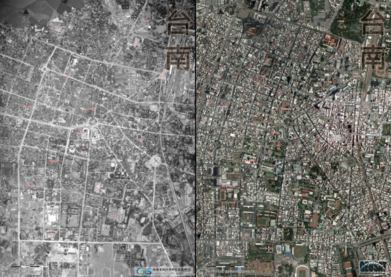
中央研究院人社中心GIS專題中心與臺南市政府地政局合作,運用1951年美軍航照(美國國家檔案館典藏)以及2010年航照(經緯衛星資訊公司拍攝)編製成「臺南新舊航照影像」海報。
下載:「臺南新舊航照影像」海報電子檔(PDF格式)
This entry was posted on 最新消息. You can follow any responses to this entry through the RSS 2.0 feed.