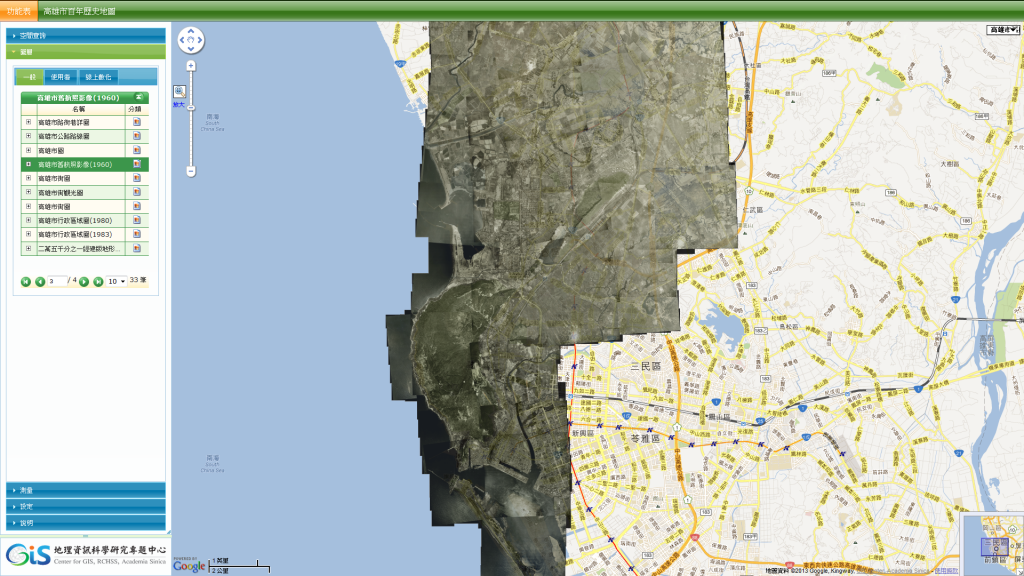
『高雄百年歷史地系統』新增1960年舊航照影像圖層內容,該圖層主要涵蓋高雄市鹽埕區、前金區、鼓山區、左營區及楠梓區,透過與今日衛星影像比對,可以見證高雄火車站北邊(後站)土地利用劇烈變遷。
This entry was posted on 最新消息. You can follow any responses to this entry through the RSS 2.0 feed.